"It feels like we are standing on the same road, just many years apart."
Video by Ammar ‘Ameezy’ Music by Syafiqah ‘Adha Sallehin
Get a clear view of the road Ang Mo Kio Ave 3 on the pavement, or walk up to the middle of the bridge to watch this video.
1
2
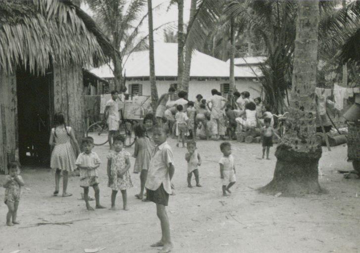
1. Villagers and children around Hwi Yoh area (1957-58). Derek Lehrle Collection, courtesy of The National Archives of Singapore
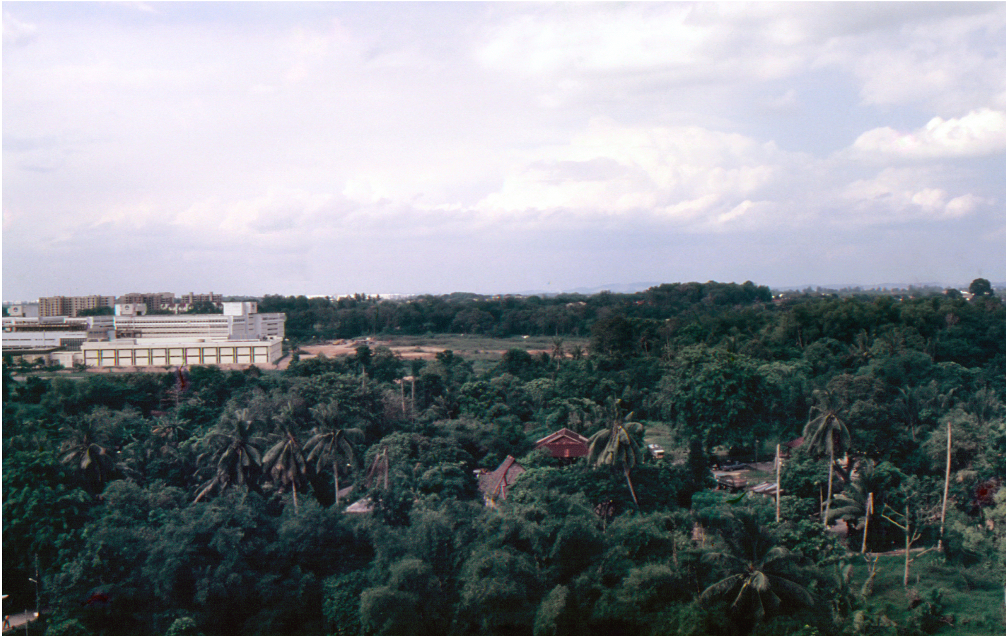
2. A view of Northern Hwi Yoh from this location in 1987. Photo by Koh Nguang How.
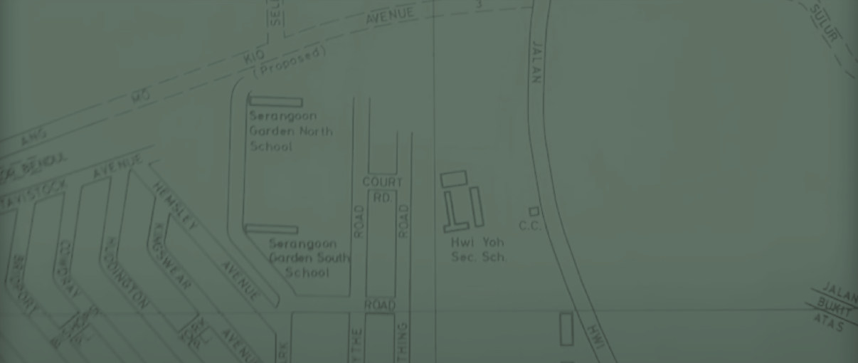
In 1979, the Street Directory of Singapore showed a “proposed road” that would later dissect Jalan Hwi Yoh into two. By 1985, Ang Mo Kio Avenue 3 was paved, which separated Serangoon North Avenue 1, 2 from Serangoon North Avenue 3, 4 and 5. This change resulted in some of the villagers’ homes being removed.
Today, only a short section of Jalan Hwi Yoh remains on its southern side. In 1989, the northern side of Jalan Hwi Yoh was broken off at Ang Mo Kio Avenue 5. Most of Jalan Hwi Yoh was then renamed as Serangoon North Avenue 1. The area continued to urbanise as industrial developments and HDB flats were built. Only the canal you see running below this road remains— once the longkang that ran through the former Kampung Hwi Yoh.
DID YOU KNOW?
Ever wondered why Serangoon North is called that?
In the 1980s, when HDB developed the Serangoon New Town housing project, the town was divided into 4 major precincts – North, Central, South and West. However, only the names for Serangoon North and Central remain widely used.


